302
Hinode Park (Literally ‘Sunrise Park’)
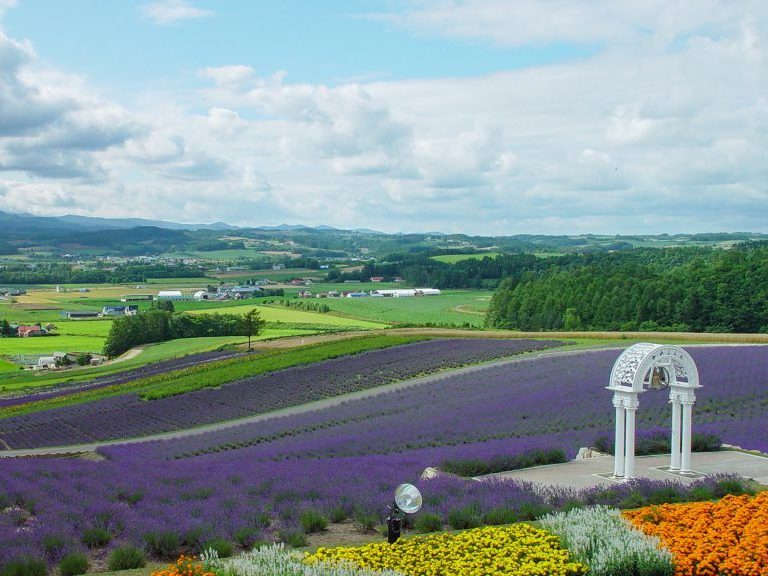
Hinode Park, on the north side of Kamifurano Town, is known for its viewing platform, lavender garden, Ski area (from mid-December through March), RV campsite (from the end of April through the end of October). Additionally, it serves as a site for various events.
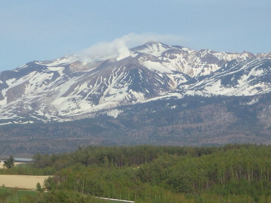
From the hilltop viewing platform, you can see the whole of the Tokachidake Mountain Range.
While some of the volcanos in this mountain range started to form 1 million years ago, the mountain which is most prominently visible today started to form around 300 thousand years ago.
The newest mountain in the range is Mt. Tokachidake.
Formed around 30,000 years ago, Mt. Tokachidake is still an active volcano.
As depicted in the photo below (on the left side), volcanic smoke can be regularly seen billowing up from the mountain.
From west-northwest of the viewing platform (see photo above), gentle, wavelike hills can be seen.
These hills formed were formed 2 million years ago, from the Biei Pyroclastic Flow Deposit, as well as from the Tokachi Pyroclastic Flow Deposit of 1.25 million years ago. Both flow deposits formed out of debris from large volcanic eruptions, which occurred in central Hokkaido (on the northeast side of Mt. Tokachidake).
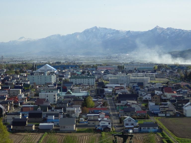
On the south-southwest side, beyond Kamifurano Town, the Yubari Mountains can be seen, with Mt. Ashibetsudake at their center (see the left section of the photo below).
Unlike Mt. Tokachidake, this mountain was formed 100 million years ago, out of stones from the ocean floor, as well as from other subterranean stones which were elevated to the surface.
| Address | Higashi 2-sen Kita 27-gou, Kamifurano town, Sorachi county, Hokkaido. |
|---|---|
| Access | By JR Furano Line.15 minute walk from “Kamifurano” station. |
| Coordinates | 43.463889,142.483056 |
| Entry | ○ |
| Public lavatory | ○ Accessible restroom |
| Parking space | ○ Free parking |


