002
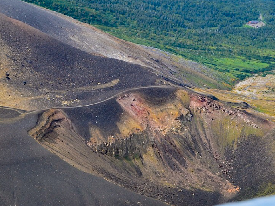
Suribachi Crater and Kitamuki Crater
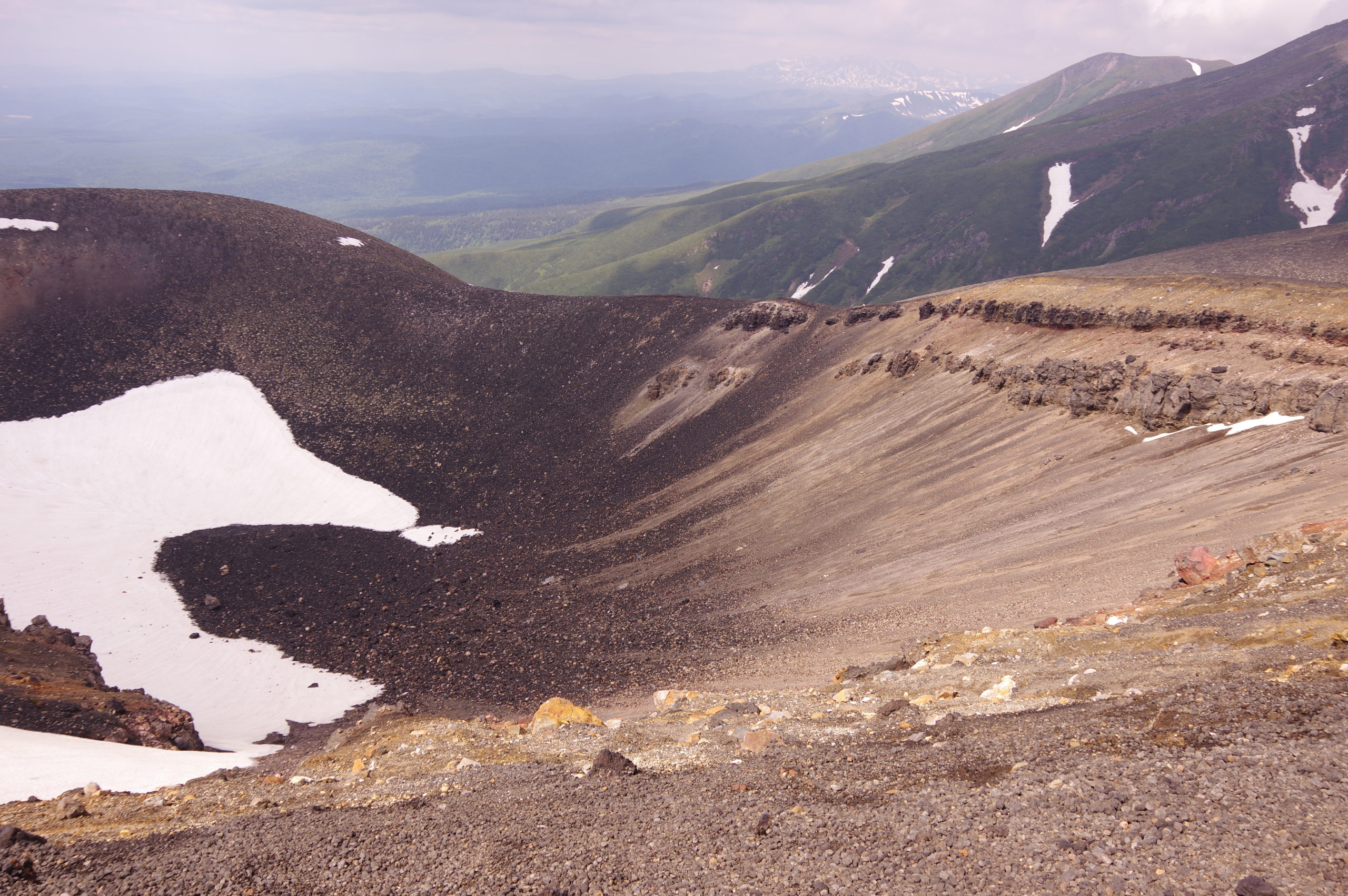
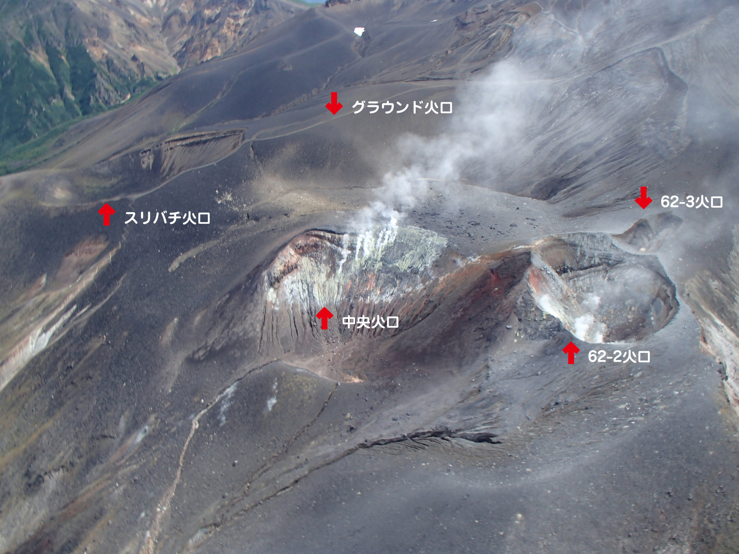
Suribachi Crater and Kitamuki Crater are located in the middle of Mt.Tokachidake north west side. “Suribachi”stands for a Japanese mortar to crush different ingredients, and “Kitamuki” means “northward” in Japanese respectively. You can observe the topographic surface of a pyroclastic cone which is ejecta from a volcano, and of "aa lava" which is rugged molten rocks.
Suribachi Crater was formed by the volcanic eruption about 1,000 years ago.
Several eruptions occurred at Kitamuki Crater during the last 500 to 1,000 years. There is a lava flow along Abaregawa River for 3.5km. You can observe topographic features which were made when the lava flowed. This lava is called black aa lava. Columnar joint can be also observed along the stream.
Suribachi Crater and Kitamuki Crater play an important role in terms of learning volcanic activities and disaster prevention of Mt.Tokachidake, since those sites allow you to see a stream of lava from mountain trails easily, and to observe a proof of a wide variety of several volcanic activities especially on a wall of Suribachi Crater.
| Address | Shirogane, Biei town, Kamikawa county, Hokkaido. |
|---|---|
| Access | No public transport (31 minutes by car from Biei Station to Bougakudai) |
| Coordinates | 43.429448,142.679830 |
| Notice | Beware of volcanic activity |
| Entry | × |
| Public lavatory | × Need a portable toilet |
| Parking space | △ Parked at Bougakudai |