A place to discover spectacular sights, eat delicious food, deepen your love for the earth, and make lasting memories.
“Geo” means “earth” in Greek. Here, it refers to natural terrain endowed with beauty and scientific value; a park where, through the study of its origins, we can strengthen our connection with the environment around us.
Theme
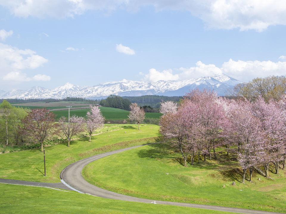
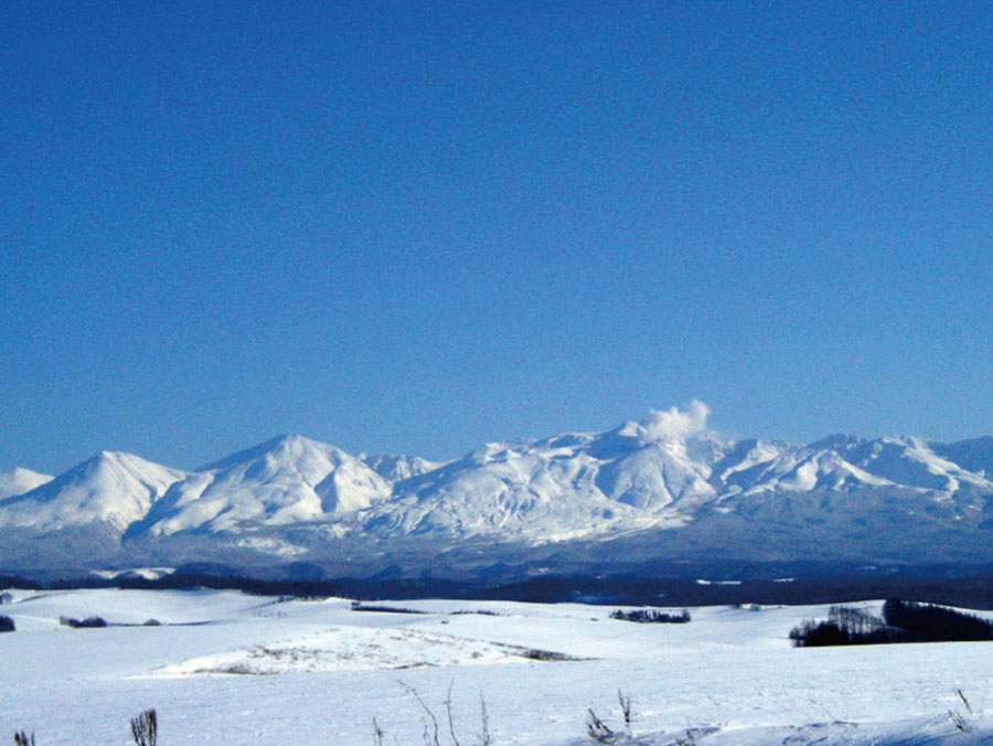
 The hills and volcanoes are interwoven with color
Theme Summary
Over a period of about 2 million years, large volcanic eruptions in the area ranging from modern day Mt. Tokachidake to the Daisetsu Mountain Range have produced pyroclastic flow deposits. These deposits have in turn gradually accumulated, forming the hills we see today. Additionally, during the last million years, the subsequent volcanic activity has formed the Mt. Tokachidake Mountain Range. By cultivating this terrain into farmland, and reaching a state of coexistence with nature, the beautiful scenery we can see here in all seasons was born.
History
The Formation of the Biei/Furano Area
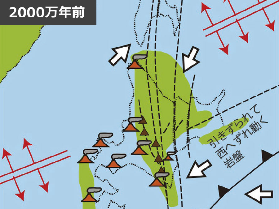
1. 20 million years ago
As the landmass of Hokkaido was formed, so were the mountains on the west side of Biei-Furano area.
![]()
2. 1-2 million years ago
A pyroclastic flow came from a volcano which was once on the east side of Mt. Tokachidake. Wavelike hills were formed from the resulting erosion.
![]()
3. 1 million years ago
Finally, the Tokachidake Mountain Range was formed from repeated eruptions.
Story
 The Roof of Hokkaido: A Tale of Mt. Tokachidake
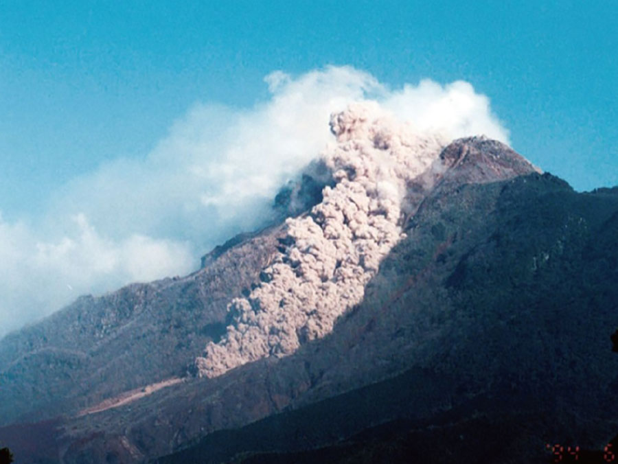
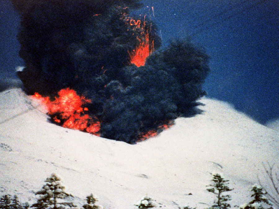
Living Together with Repeated Eruptions
Because Mt. Tokachidake erupts approximately every 30 years, it has become a valuable place for experiencing and observing lava flow, pyroclastic flow, mud flow, and other such traces left behind from eruptions. Through this story, we will learn about volcanic activity in the region, and introduce the lives of the people who have lived together with, and at the mercy of, these volcanoes.
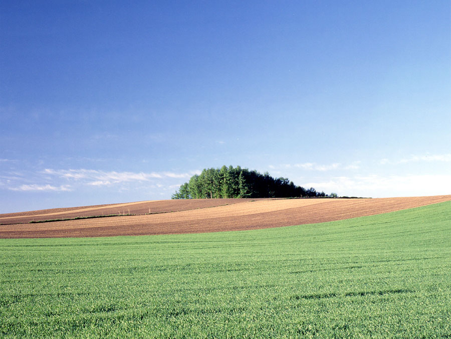
 The Beautiful Hill Town and its Coexistence with the Volcanoes Born Out of the Surrounding Terrain
Pyroclastic Flow and Farming: A Collaboration
Back in the days when the entire region was covered by a wilderness of primeval forests, it was not possible to see the wavelike hills formed by pyroclastic flow. The form of these hills was first noticed by settlers who came to the area roughly 130 years ago, cultivating the primeval forests into farmland. While the terrain is characterized by its good natural drainage, it also has steep slopes, and soil containing quartz, which can damage farming equipment. These features were a cause of hardship to settlers. Next, we will introduce the hardships involved in developing the farmland which rests upon the wavelike hills.
 Developing this Northern Land Marked by the Traces of Volcanic Mudflow
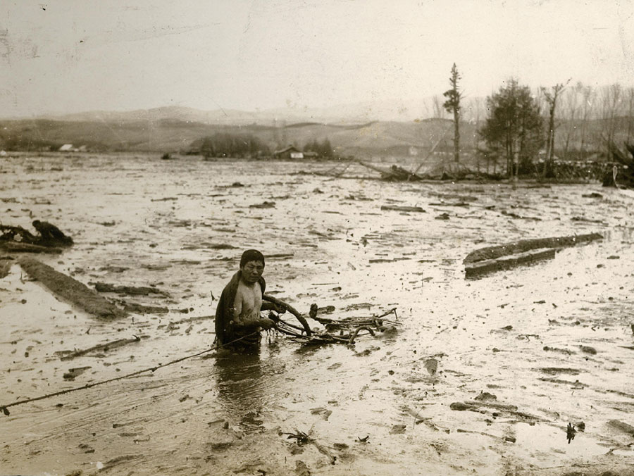
A Volcanic hazard and recovery from the disaster
In 1926, Mt. Tokachidake erupted, melting the snow around the mountain and causing a mudflow. The volcanic mud flowed into vast stretches of farmland, and resulted in 144 victims. We wish to convey to our visitors the hardship and endurance of the pioneers who lived through this time, as told in MIURA Ayako’s novel "Deiryu Chitai (the Mudflow Zone", and its sequel.
Our Idea
In Biei and Kamifurano Towns, the beautiful hilly scenery is spread across land formed by the volcanic activities of Mt. Tokachidake. Upon these hills lies rich farmland, like a crystal containing the hopes and hardships of its people. Also here are natural hot springs, with their healing powers, and the blessing of abundant natural resources. These natural resources have been inherited by the people of the region, together with their history and culture, all of it intertwined with the suffering and recovery from volcanic disasters. By protecting the charm of these natural resources, studying them, teaching others about them, and working to create and live together with this high-quality environment, we hope to make proud the future people of the region.
Our Foundation
(1) We wish for our two towns to work together in the face of the next volcanic eruption.
(2) We wish for everyone in the region to learn about the volcano and surrounding nature.
(3) We hope to pass on this blessed land and its culture to future generations.
(4) We hope to raise the quality of tourism, so that everybody loves our region.
(5) We wish to coordinate with other regions from around the world, and exchange information
Logo

This logo was designed with the motif of Mt. Tokachidake and the wavelike hills, as a grand panorama of nature.
About the Japanese Geopark Network
The Japanese Geopark Network is a group in which Geoparks and regions aiming to become Geoparks cooperate with each other to carry out better regional promotion, conservation, and education. To become a full member of the Japanese Geopark Network, and therefore be officially identified as a Geopark, it is necessary to pass an evaluation (both through documentation and on-site examination evaluation) given by the Japanese Geopark Committee.
Our Initiatives
Training for Guides

●Training for Guides and Support Staff
Training courses for guides and support staff are being held.
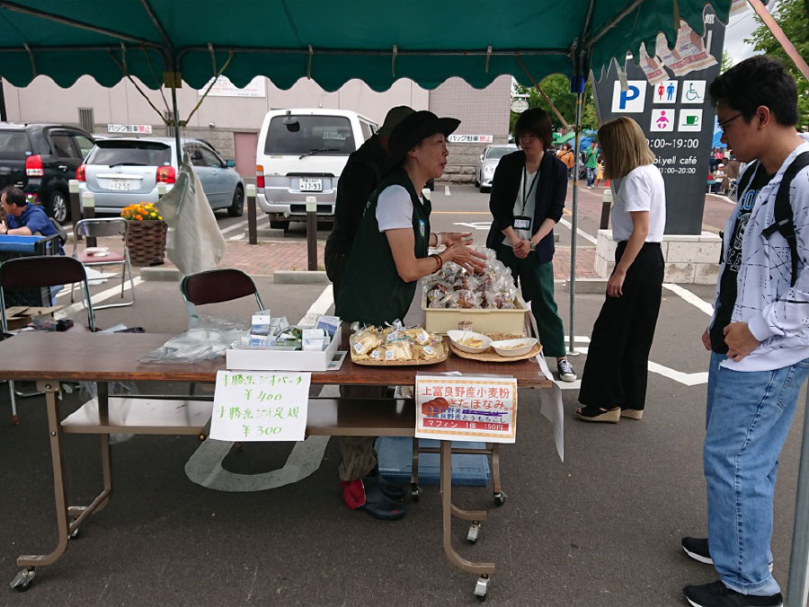
●Monitor Tours
We hold monitor tours four times per year. We are also investigating the possibility of commercializing, by inviting a travel agency to open in the area. Mini-tours are also being offered.
Geo Club
In July 2019, the Tokachidake Geoclub, a group which independently enjoys and learns about Geopark activities, was established, starting activities with a focus on Geosupporters.
Promotional System
●Strengthening the Activities of Our Specialized Subcommittees
They are working on the following activities, with a focus on regional organizations and other people living in the area.
•Subcommittee for Tourism: the creation of a trekking map.
•Subcommittee for Regional Promotion: implementation of Geopark training for local residents.
•Subcommittee for Industry: the development and distribution of novelty products.
•Subcommittee for Disaster Prevention and Education: holding a free-research competition during summer vacation.
●Office of the Secretariat
The Tokachidake Geopark Promotion Committee Secretariat has been established. It is located on the 3rd floor of Biei Town Hall. The staff of Biei and Kamifurano Towns are working together in this endeavor.
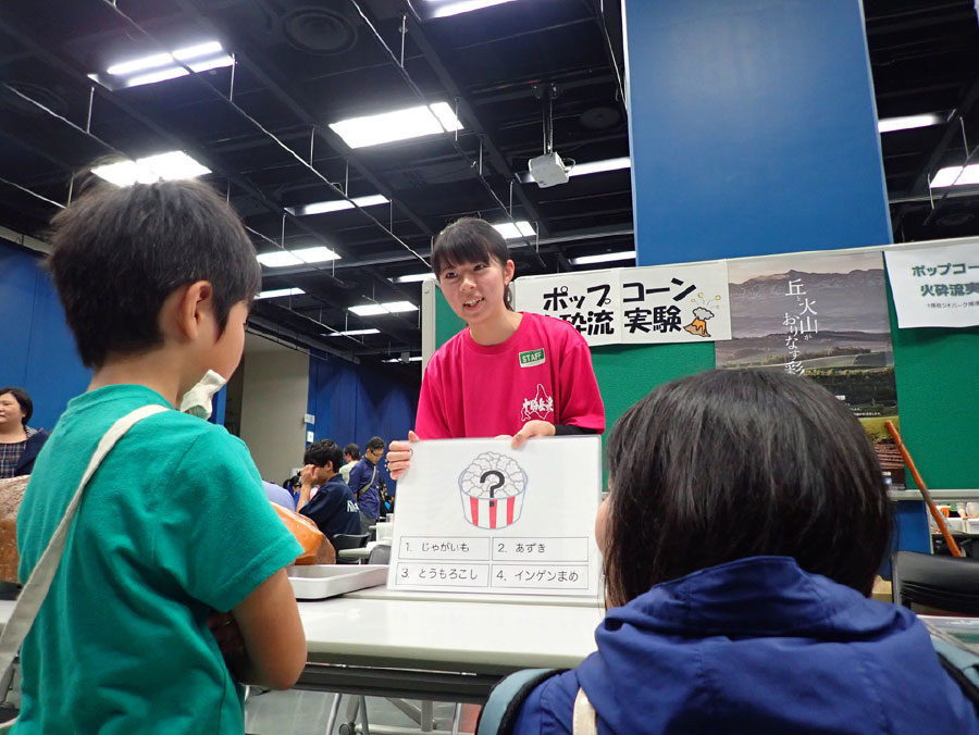
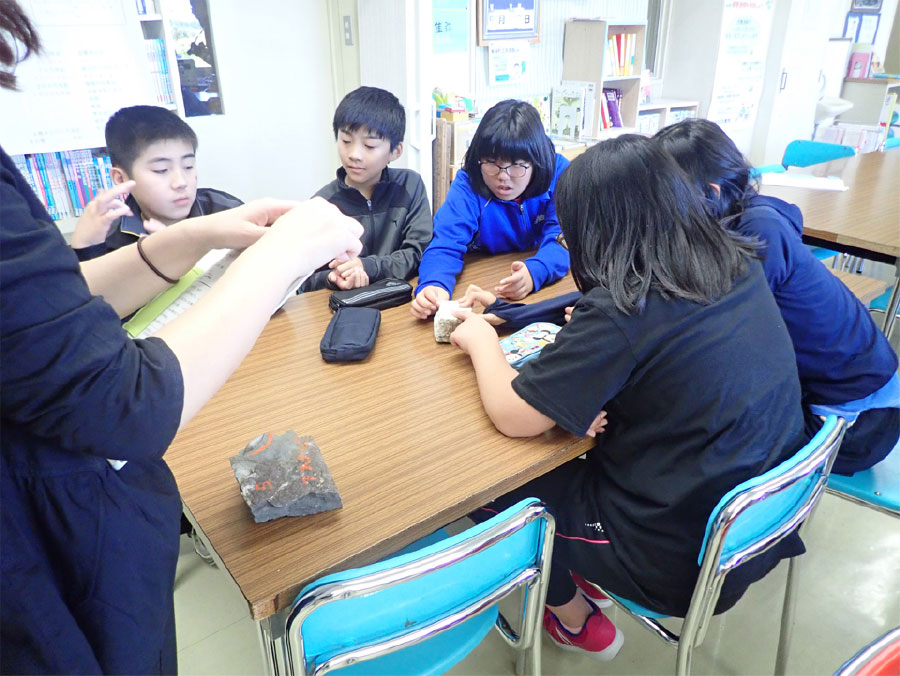
Education Regarding Our Region
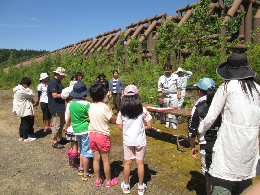
●Disaster Prevention Education
In cooperation with the national and local government, Tokachidake Geopark Promotion Committee visits all local Elementary School 4th grade classes, to teach children and parents about volcanic erosion control. We are trying to raise awareness about disaster prevention.
●Local Education
Together with the National Daisetsuzan Youth Exchange House, the Boards of Education of Biei and Kamifurano Towns, Tokachidake Geopark Promotion Committee carries out social educations based on geopark-activity.
Promotion and Cooperation
●The implementation of talks/lectures on-demand
●The holding of regional events
●Coordination with JGN (Japanese Geopark Network), blogs, and other relevant agencies.
●Participation in various types of research seminars and events.
●Participation in “Geofest.”
Education in Schools
In addition to education about volcanic disaster prevention and other education about the region, further education initiatives will be implemented to teach high school children about sustainable development goals (SDGs) and Geopark development. All children in the area will have this opportunity to learn about the Tokachidake Geopark.